
Poet's Walk, Clevedon
Walk Highlights
- Nearest Town:
- Clevedon
- Postcode:
- BS21 7QU
- Parking:
Parking is located close to Clevedon Pier, along the road. Additional car parks can be found close to Clevedon Salthouse Park.
- Distance:
- 2.30 miles
- Time:
- 1.20 hours
- Difficulty:
- Easy
- Facilities:
- Toilets, Cafe, Pub Nearby, - Facilities: Public toilets, shops, pubs, restaurants.
- Get Directions:
-
Get driving directions to the starting point:
Create a free account to make this useful beyond one walk
Save walks, build a shortlist, report current conditions, and join the local dog-walking community.
3-Day Dog Walking Forecast
Ground Conditions
No reports yet. Walked this recently?
Dog-Centric Details
- Stile-Free Walk:
- Yes
- Poo Bins Available:
- Yes
- Secure/Fenced Area:
- No
- Dog Water Source:
- No
- Dog Notes:
- EV Charger Nearby:
- No
- Fuel Station Nearby:
- No
- Livestock Information:
- Off-Leash Policy:
- On-Leash Only
- Dog Traffic:
- Moderate
- Seasonal Advice:
- Height Restriction:
- No
- Printable Version:
- Open & Print
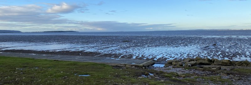
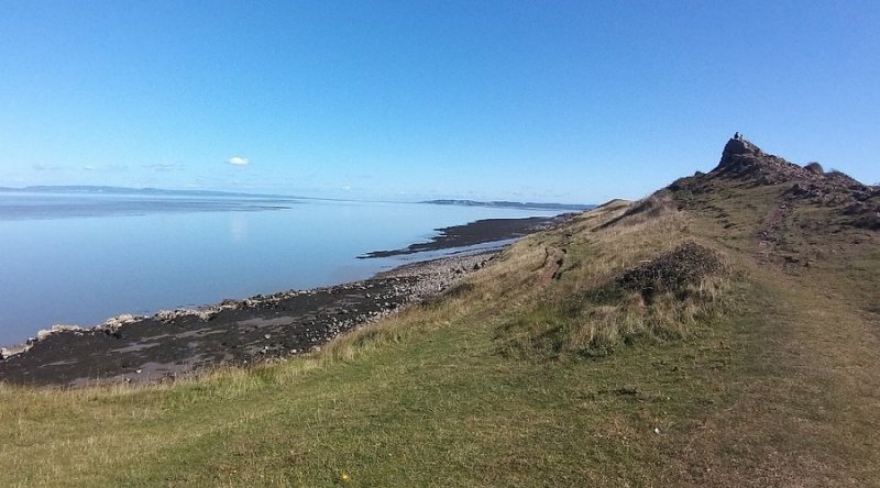
The Poets Walk is so named because many poets and writers visited Clevedon. This walk takes you along the coast and through a path along the cliff edge, with views across to South Wales.
How to get there
From the M5, take Junction 20, heading west along the B3133, then the B3130.
Walk
1 Parking is located all along the road next to Clevedon Pier. From the car park, head south, keeping the coast to your right. You will pass a bandstand on your left, along with a range of benches.
2 Pass by Marine Lake which will be on your right and follow this round to point 3.
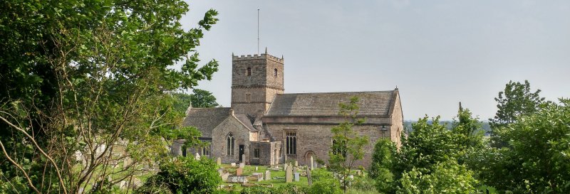
3 Once you have passed the Lake, you will reach a small historical landmark, the Lookout which starts Poet’s Walk. The Lookout was erected around 1835 and is said to have been used by sugar importers, who would in the mid-19th-century view sugar boats heading up the Bristol Channel. Continue on down the path, straight ahead, and passing the picturesque St. Andrew’s Church to your left.
4 Follow the cliff edge path round Wain’s Hill to your left. Wain’s Hill was an Iron Age hillfort (c.300 B.C.). Continue onward as the path goes downhill to the road below.
5 Turn left onto Old Church Road, which heads up to the entrance of St. Andrew’s Church. There is a path to the right of the gated entrance to the church grounds, take this as it heads uphill, and take a right at the end of the path to re-join the original route, which you can trace back to the car park.
Grid Reference: ST 402 716
Safety Disclaimer
Outdoor activities always involve an element of risk. Routes, terrain, surfaces, weather, access, livestock presence, water levels, and parking arrangements can change at any time, and path conditions may deteriorate without notice.
You are responsible for your own safety and for the safety, supervision, and wellbeing of your dogs, children, and anyone else with you. Please assess conditions for yourself before setting out and decide whether the walk is suitable for your group.
Dress appropriately for the conditions and bring suitable equipment, food, water, leads, navigation tools, and anything else needed for a safe outing. Trail Tails Ltd is not responsible for loss, damage, injury, incident, or any consequences arising from use of this information.
Help Keep This Walk Accurate
If anything has changed or looks incorrect, please send us an edit or update suggestion.
Suggest an Edit or UpdateMap
Share this walk:
Other Walks Nearby
More walks nearby
Create a free account to keep exploring nearby walks and build a shortlist.
Create Free Account
Comments & Reviews (0)
Get More From This Walk!
Create a free account to save this walk, rate it, and share your experience.
Be the first to comment on this walk!