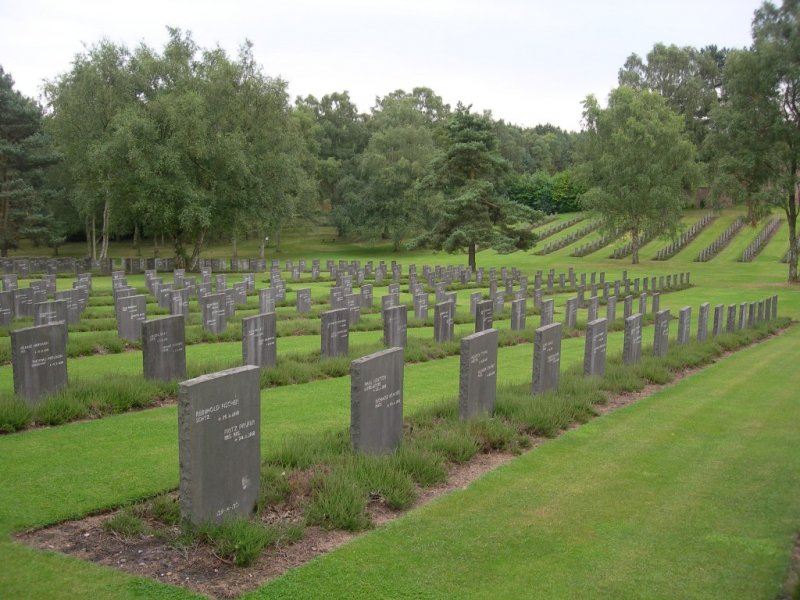
German Military Cemetery

Published on | Category: Staffordshire | Location: Cannock Chase, Staffordshire
Featured image for German Military Cemetery

Walk Highlights

Location:
Cannock Chase, Staffordshire
Postcode:
WS12 4PT
Parking:
A car park is located just off Camp Road. If this is full, travel a little further to the north on Camp Road and the next right there is another car parking area.
Distance:
1.50 miles
Time:
1.00 hours
Difficulty:
Easy
Terrain:
Woodland paths.
Facilities:
Toilets, - Facilities: Toilets (in the visitor building).
OS Map Route:
View Route on OS Maps

Set amongst the trees and against Cannock Chase, the German Military Cemetery is maintained by the Commonwealth War Graves Commission. This walk skirts the edge of the Cemetery, allowing you to view the area as you walk by, and continue onto Cannock Chase itself.


How to get there

From the M6, exit at Junction 11, taking the A460 toward Cannock town centre. From here, take the A34, Cannock to Stafford. Follow for around 3 miles to a roundabout, with signs to Rugeley. After about 1 mile, turn right, then left at a crossroads. The Cemetery is signposted on the A34.


Walk

1 Begin the walk at the car park, which is alongside the Commonwealth War Cemetery. Walk along the path, away from the road and past the entrance gate. Follow the path down with trees lining either side.

2 You pass on your left a clearing where the end of your walk will emerge from, but for now continue on down toward the German Military Cemetery. You will pass the Cemetery with it being on your left, passing the entrance and then onward so that you can see the site. Continue on past it in a straight line.

3 The path rounds to the left. Follow this onward with trees to your right and the open area to your left. You will then reach a fork with the option to turn a relative sharp left or continue to the bend on the right.

4 Choose the sharp left option, and head back along this path, which somewhat follows in the opposite direction to the original straight line walk.

5 You will reach a point where there are numerous paths leading off to the left and right of the main path you are on. For this walk, remain on the main path heading straight on, and eventually over a slight rise.

6 You meet up with another car parking area. From here turn immediately left to head down a path. Turn right to walk parallel to the very beginning of the walk, but on the other side of the trees. You will then reach the entry point to the walk and subsequently the car park.


Grid Reference: SJ 984157
what3words: ///rinses.crumbles.lively

Information Accuracy

While we strive to ensure all walk details are accurate and up-to-date, conditions can change. Please verify critical information locally where possible. Dog Walks Near Me cannot be held accountable for errors or omissions in the provided walk information. Your safety is your own responsibility.

Report an Issue with this Walk

Map

View full route on OS Maps

Share this walk:

Comments & Reviews (0)

Log in or register to leave a comment.

Be the first to comment on this walk!