Clayton Vale

Walk Highlights
- Nearest Town:
- Manchester
- Postcode:
- M11 4RU
- Parking:
Main car park off Berry Brow (for Vale & MTB centre), usually free. Can be busy. Hub may have cafe/toilets.
- Distance:
- 2.90 miles
- Time:
- 1.10 hours
- Difficulty:
- Easy
- Terrain:
Terrain: Clayton Vale offers a surprisingly varied terrain for an urban fringe country park. Paths along the River Medlock are generally flat and can be a mix of surfaced (compacted stone/gravel) and earthier sections (muddy after rain). Woodland paths on the valley sides can be steep, uneven, rooty, and muddy. Open meadow areas exist. The dedicated mountain bike trails are specially constructed with berms, jumps, and technical sections (walkers should keep clear of active bike trails unless they are clearly designated shared-use and safe to do so).
- Get Directions:
-
Get driving directions to the starting point:
3-Day Dog Walking Forecast
Ground Conditions
No reports yet. Walked this recently?
Dog-Centric Details
- Poo Bins Available:
- Yes
- Secure/Fenced Area:
- No
- Dog Water Source:
- Yes
- Dog Notes:
Dog Considerations:
- Leads: Clayton Vale is popular with walkers, families, and importantly, mountain bikers using the National Cycling Centre trails. While there are woodland and riverside areas where off-lead exercise may be possible for very well-behaved dogs with excellent recall, it is **CRUCIAL to keep dogs on leads or under extremely close control on or near any mountain bike trails** to prevent collisions and injury (to dog, rider, or walker). On main shared paths, especially when busy or near the visitor hub/car park, leads are advisable.
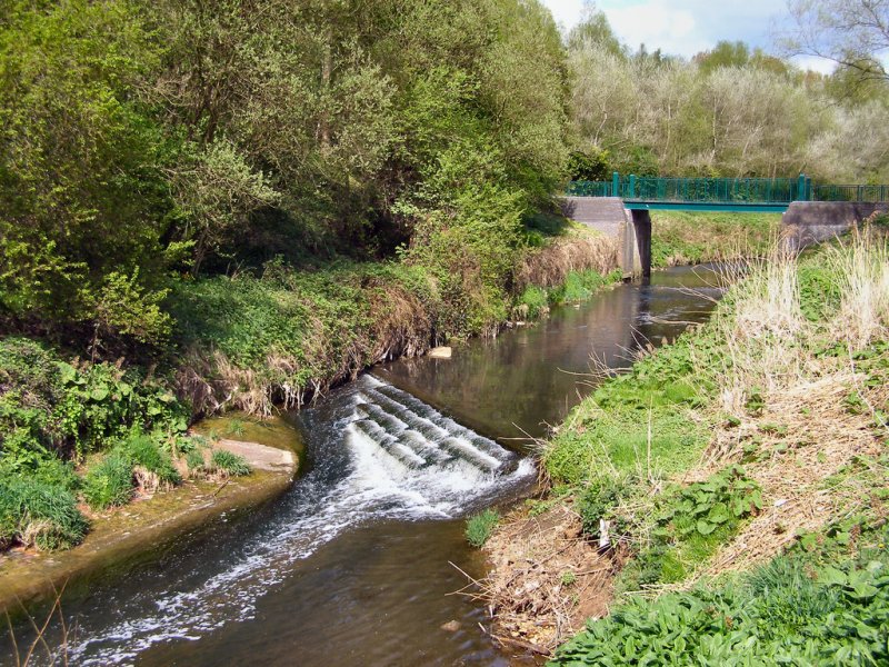
- Water: The River Medlock flows through the Vale, offering paddling opportunities (assess water quality and safe access points, urban river). Carry fresh water.
- Wildlife: Woodland birds, squirrels, potentially kingfishers along the river. Ensure dogs do not chase or disturb wildlife.
- Dog Bins: Usually available at the main car park/visitor hub area and sometimes at other key path junctions.
- Hazards: Mountain bikers (can be fast-moving and appear suddenly on trails – be extremely alert). River Medlock (currents, pollution). Steep and slippery woodland paths. Some areas can feel remote. Potential for litter in urban fringe areas.
- EV Charger Nearby:
- No
- Fuel Station Nearby:
- No
- Livestock Information:
- Off-Leash Policy:
- Full Off-Leash
- Dog Traffic:
- Busy
- Seasonal Advice:
- Height Restriction:
- No
- Printable Version:
- Open & Print
Starting Point: Main car park for Clayton Vale, off Berry Brow, Clayton, Manchester (Postcode: M11 4BR for the main Vale car park and visitor hub with mountain bike facilities). Alternative access points from surrounding areas like Clayton Bridge or Edge Lane.
Approximate Distance: 2 - 5 miles (3.2 - 8 km), with a network of paths along the River Medlock, through woodlands, meadows, and incorporating the National Cycling Centre MTB trails (walkers should be mindful of cyclists).
Estimated Time: 1 - 2.5 hours, depending on the chosen route and exploration.
Walk Description:
1. From the Main Car Park/Hub: Start from the main car park off Berry Brow, which is often co-located with facilities for the National Cycling Centre's mountain bike trails and may have a small visitor point or cafe.
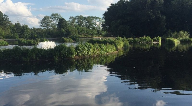
2. River Medlock Paths: Follow the paths that run alongside or close to the River Medlock as it winds its way through the Vale. These sections offer pleasant waterside scenery within a green corridor.
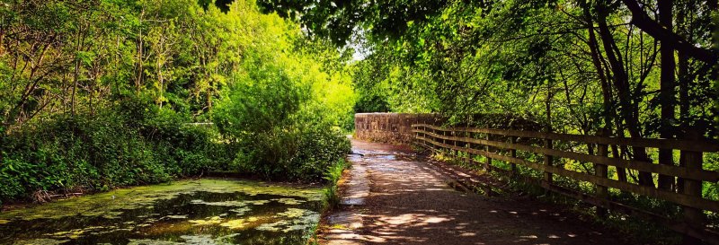
3. Woodland Trails: Explore the network of paths that climb up into the woodlands on the valley sides. These offer shadier, more natural walking and can provide good views down into the Vale.
4. Meadow Areas and Open Space: Some parts of Clayton Vale open out into grassy meadows, providing a contrast to the woodland and river sections.
5. Observing Mountain Biking (from a safe distance): The Vale is home to purpose-built mountain bike trails. If interested, you can often watch bikers on these trails from safe vantage points on walking paths, but do not walk on active bike-only trails.
6. Linking to Philips Park / Ashton Canal (Optional): Clayton Vale can be a link in a longer walk, potentially connecting towards Philips Park (Manchester, not Prestwich) or the Ashton Canal towpath via local routes if you have an OS map and plan carefully.
Highlights:
- A significant urban green lung following the River Medlock valley.
- Pleasant riverside and woodland walking.
- Home to the National Cycling Centre's mountain bike trails (for bikers, or observing for walkers).
- A reclaimed landscape with a mix of natural regeneration and managed paths.
- Good for local wildlife spotting.
Tips for Your Walk:
- BEWARE OF BIKES: This is a key consideration. Stick to designated walking paths. If on shared-use paths, be alert for cyclists approaching, keep to one side, and ensure dogs are controlled. Do NOT let dogs run onto dedicated bike trails.
- Manchester City Council/NCC Website: Check for information on Clayton Vale, any specific guidance for walkers vs cyclists, facility opening times, and parking.
- Footwear: Waterproof walking shoes or boots are highly advisable due to likely muddy and uneven woodland/riverside paths.
- Path Network: Can be a bit of a maze in places. An OS map (Explorer 277 Manchester & Salford) is useful if venturing beyond very obvious main paths.
Clayton Vale offers an interesting mix of riverside, woodland, and meadow walking with the added dynamic of the mountain bike trails. It's essential for walkers and dog owners to be highly aware and respectful of cyclists using the dedicated trails.
Image: © Copyright David Dixon and licensed for reuse under this Creative Commons Licence.
Information Accuracy
Conditions can change. Please verify critical information locally. Your safety is your responsibility.
Report an Issue


Comments & Reviews (0)
Get More From This Walk!
Create a free account to save this walk, rate it, and share your experience.
Be the first to comment on this walk!