Premium Walk
Werneth Low Country Park

Walk Highlights
- Nearest Town:
- Hyde
- Postcode:
- Unlock Postcode
- Parking:
- Unlock Parking Info
- Distance:
- 1.80 miles
- Time:
- 1.20 hours
- Difficulty:
- Moderate
- Terrain:
Hilltop country park: Surfaced paths near car park/cenotaph. Grassy/earthy moorland/woodland paths (uneven, muddy, steep slopes). Exposed.
- Facilities:
- Toilets, Pub Nearby
- Get Directions:
- Unlock Driving Directions
3-Day Dog Walking Forecast
Loading forecast...
Powered by Open-Meteo
Ground Conditions
No reports yet. Walked this recently?
Dog-Centric Details
- Poo Bins Available:
- Yes
- Secure/Fenced Area:
- No
- Dog Water Source:
- No
- Dog Notes:
Very popular. Off-lead common on open hill if controlled. MUST BE ON LEAD NEAR LIVESTOCK (common) & cenotaph/busy areas. Carry water. Bins at car parks.
- EV Charger Nearby:
- No
- Fuel Station Nearby:
- No
- Livestock Information:
- Off-Leash Policy:
- Full Off-Leash
- Dog Traffic:
- Busy
- Seasonal Advice:
- Height Restriction:
- No
- Printable Version:
- Upgrade to Plus to Print
About this Walk
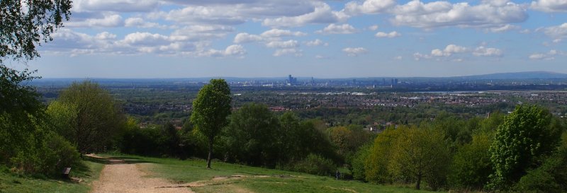
A circular dog friendly walk around Werneth Low Country Park. The country park extends for 80 hectares (200 acres) across the Northern and Western slopes of Werneth Low. Only 9.5 miles from the city centre of Manchester, the area is both a haven for wildlife and an area where visitors can find peace...
