logo logo logo logo
  • England
    • North West
    • North East
    • Yorkshire
    • West Midlands
    • East Midlands
    • East of England
    • South West
    • South East
    • Greater London
    • Lake District
    • Peak District
    • South Downs
  • Scotland
    • Highlands
    • Lowlands
    • Cairngorms
  • Wales
    • North Wales
    • South Wales
    • Anglesey
    • Snowdonia
  • Holiday Cottages
  • Store
  • Blog
  • Tennyson Down

    Isle of Wight

Tennyson Down

Circular walk


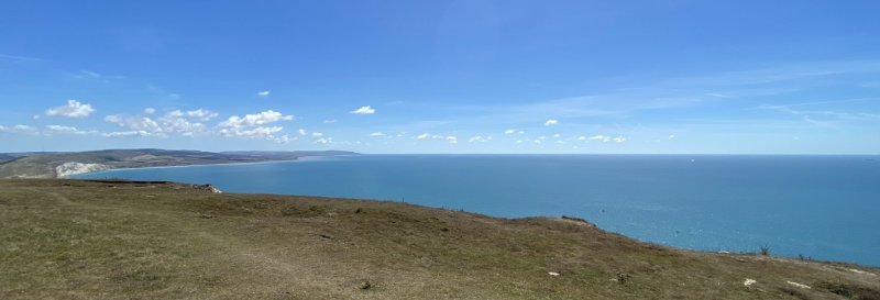
A challenging downland walk, providing some great views, at Tennyson Down. Tennyson Down is a hill at the west end of the Isle of Wight just south of Totland. Tennyson Down is a grassy, ridge of chalk which rises 147m above sea level.

OS Map: OS map available here.

National Trust Membership: For free parking at most National Trust car parks, and free entry to over 500 places - join here.

Useful Information

How to get there: B3322 from Yarmouth/Totland or Alum Bay road from Freshwater Bay.

Grid Reference: SZ 324 856
what3words: ///rivers.wishes.canoe
Nearest Postcode: PO39 0HY
Parking: Tennyson Down car park.
Facilities: Facilities at the Needles Park.

Distance

4 miles

Difficulty

Challenging

Time

1hr 45min

The Walk

A challenging downland walk, providing some great views.

Map with thanks to Ordnance Survey.

Walk

1 Facing the quarry, follow the left-hand path out of the car park. Take a right to climb the steps by a wooden bench, signposted T27. Pass through the kissing gate to the top of the hill.

2 When you reach the Tennyson Monument, turn right to follow on any of the cliff-top paths, with an aim of the aerial mast visible on the skyline to the west. Head to the right of the aerial building, then head diagonally left and down to a concrete road. Cross the road and follow the signs to the Needles viewpoint.

3 Return to the road, then turn left and climb the steps on the left, before the New Battery. Follow the path down to the Needles Old Battery, then the road towards Alum Bay.

4 At the corner, go straight ahead, signposted T25. Climb some steps and pass through the kissing gate. Remain on the path along the lower boundary of the slope, with a fence on the left until it starts to rise. Take the path diagonally upward to a beacon. Pass through a gate and take the path T24 gently downhill on the left, back to the car park after a gate.

Similar Walks

Two further walks to consider in the South East.

Bembridge Fort and Downs Bembridge Fort and Downs, Isle of Wight - Dog Walks Near Me

45min

Time

1.6 miles

Distance

Easy

Difficulty

Bembridge Fort and Downs

Circular Walk

Isle of Wight

Southsea Common Southsea Common, Portsmouth - Dog Walks Near Me

1 hr

Time

1.8 miles

Distance

Easy

Difficulty

Southsea Common

Circular Walk

Portsmouth

Enjoy this walk?

Say thanks with a coffee.

Our Affiliate Partners

North Face
client logo
Berghaus
Ordnance Survey
Jack Wolfskin UK
AATU
Dog Walks Near Me
  • Find dog walks across the UK
  • About Us
  • Support Dog Walks Near Me
Top Walk Areas
  • Peak District National Park
  • Lake District National Park
  • Cornwall Region
  • South East Region
Own A Dog Friendly Business?
  • Advertise with us. This is ideal if your business is a dog friendly place to visit such as gardens, secure dog fields, museums, zoos, etc.
Mahlow the Greyhound
  • A blog where we share additional content related to the wider-world

Contact Us
  • Email
© Dog Walks Near Me | Cookie & Privacy Policy