
Dunmore Estate
Walk Highlights
- Nearest Town:
- Falkirk
- Postcode:
- FK5 4BE
- Parking:
NTS car park at The Pineapple (charges may apply for non-members). Limited informal parking near other footpath entrances from Dunmore/Airth; park considerately.
- Distance:
- 3.50 miles
- Time:
- 1.80 hours
- Difficulty:
- Easy
- Terrain:
Terrain: A network of woodland paths, estate tracks, and some parkland walks. Paths can be earthy, grassy, sometimes muddy and uneven with tree roots. Some sections may be on quieter estate roads. Generally undulating with some gentle to moderate slopes.
- Facilities:
- An all-ability path leads from the car park to the pond viewing platform.
- Accessibility:
- Yes
- Get Directions:
-
Get driving directions to the starting point:
Create a free account to make this useful beyond one walk
Save walks, build a shortlist, report current conditions, and join the local dog-walking community.
3-Day Dog Walking Forecast
Ground Conditions
No reports yet. Walked this recently?
Dog-Centric Details
- Poo Bins Available:
- No
- Secure/Fenced Area:
- No
- Dog Water Source:
- No
- Dog Notes:
Dog Considerations:
- Leads: The Dunmore Estate is largely private, with public access often via permissive paths or rights of way through woodland and parkland. Dogs should be kept on leads or under very close control, especially as it's a former working estate that may still have some agricultural activity or game birds. Be mindful of any specific signage.
- Water: Natural water sources like streams might be present in woodlands, but carry fresh water.
- Wildlife & Game: The estate is rich in wildlife, including deer, red squirrels, and game birds. Strict control of dogs is essential to prevent disturbance.
- Dog Bins: Unlikely within the main estate woodlands. Expect to take dog waste home or use bins if visiting The Pineapple (NTS).
- Hazards: Uneven paths, tree roots, potentially some farm traffic on estate roads. Old estate buildings/ruins may be present (observe from a distance unless clearly safe and open for access).
- EV Charger Nearby:
- No
- Fuel Station Nearby:
- No
- Livestock Information:
- Off-Leash Policy:
- On-Leash Only
- Dog Traffic:
- Moderate
- Seasonal Advice:
- Height Restriction:
- No
- Printable Version:
- Open & Print
Starting Point: Access to the Dunmore Estate is often near The Pineapple (National Trust for Scotland landmark, FK5 4BE), or from public footpaths around the village of Dunmore or Airth.
Approximate Distance: 2 - 5 miles (3.2 - 8 km) for a circular walk exploring the woodlands and parkland of the historic estate.
Estimated Time: 1 - 2.5 hours, depending on route and exploration.
Walk Description:
1. Accessing the Estate: Start from a suitable access point. If visiting The Pineapple (NTS), their car park provides good access to some estate paths. Otherwise, use public rights of way from Dunmore village or near Airth.
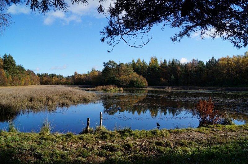
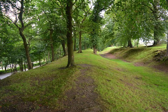
2. Woodland Trails: Explore the extensive mixed woodlands on the estate. Paths, often historic carriage drives or forestry tracks, wind through mature trees, offering a peaceful and sheltered walking experience.
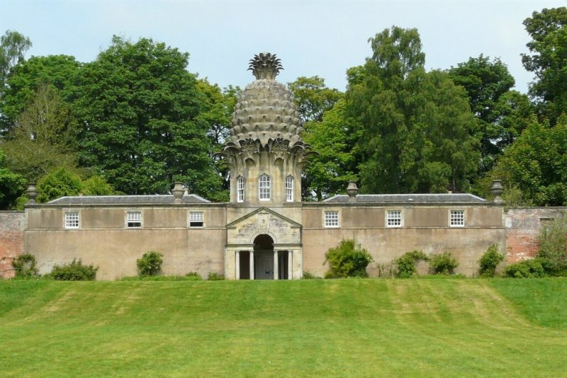
3. The Pineapple (Optional Visit): A key feature of the area is The Pineapple, a unique and eccentric 18th-century summerhouse (now a holiday let by NTS, grounds usually accessible). Paths often lead through the woods surrounding it.
4. Parkland and Estate Features: Some routes may cross areas of former parkland, offering more open views. You might also see other historic estate features like old walls, gatehouses, or the ruins of Dunmore Park House (usually viewed from a distance as it's derelict and unsafe).
5. Circular Routes: Link different paths and tracks to create a circular walk. An OS map is helpful for navigating the estate's path network.
Highlights:
- Exploring the extensive woodlands and parkland of a historic Scottish estate.
- The unique architectural folly of The Pineapple (exterior viewing).
- A tranquil atmosphere with good opportunities for wildlife spotting (especially red squirrels and deer).
- Walking on historic carriage drives and woodland paths.
- Views towards the River Forth from certain parts of the estate.
Tips for Your Walk:
- OS Map: OS Explorer map 366 (Stirling & Ochil Hills West) or 367 (Dunfermline, Kirkcaldy & Glenrothes South) is useful for navigating the estate.
- The Pineapple (NTS): Check National Trust for Scotland for access details to The Pineapple grounds and holiday let. There's usually a small car park here.
- Respect the Estate: Much of the land is private; stick to clear paths and rights of way. Follow the Scottish Outdoor Access Code.
- Footwear: Waterproof walking boots are recommended due to potentially muddy and uneven woodland paths.
The Dunmore Estate offers a peaceful and historically interesting walking experience through classic Scottish estate landscapes.
Image: © Copyright Richard Sutcliffe and licensed for reuse under this Creative Commons Licence.
Safety Disclaimer
Outdoor activities always involve an element of risk. Routes, terrain, surfaces, weather, access, livestock presence, water levels, and parking arrangements can change at any time, and path conditions may deteriorate without notice.
You are responsible for your own safety and for the safety, supervision, and wellbeing of your dogs, children, and anyone else with you. Please assess conditions for yourself before setting out and decide whether the walk is suitable for your group.
Dress appropriately for the conditions and bring suitable equipment, food, water, leads, navigation tools, and anything else needed for a safe outing. Trail Tails Ltd is not responsible for loss, damage, injury, incident, or any consequences arising from use of this information.
Help Keep This Walk Accurate
If anything has changed or looks incorrect, please send us an edit or update suggestion.
Suggest an Edit or UpdateMap
Share this walk:
Other Walks Nearby
More walks nearby
Create a free account to keep exploring nearby walks and build a shortlist.
Create Free Account
Comments & Reviews (0)
Get More From This Walk!
Create a free account to save this walk, rate it, and share your experience.
Be the first to comment on this walk!