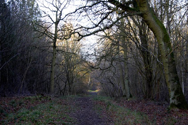
Bourne Wood

Walk Highlights
- Location:
- Bourne
- Postcode:
- PE10 0LG
- Parking:
Large pay and display Forestry England car park off Beech Avenue. Toilets/cafe often available. Smaller informal parking at other entrances.
- Distance:
- 4.00 miles
- Time:
- 2.00 hours
- Difficulty:
- Easy
- Terrain:
Terrain: A comprehensive network of paths. Main forest roads are often wide, well-surfaced (compacted stone/gravel), and relatively flat, suitable for many abilities including some pushchair/wheelchair access. Smaller footpaths are earthier, can be uneven, rooty, and will become muddy after rain. The woods are generally gently undulating.
- Get Directions:
-
Get driving directions to the starting point with a Premium Membership.
Upgrade to Unlock
Premium Dog-Centric Details
PLUS- Stile-Free Walk:
- Locked
- Poo Bins Available:
- Locked
- Secure/Fenced Area:
- Locked
- Dog Water Source:
- Locked
- Dog Notes:
- Locked
- EV Charger Nearby:
- Locked
- Fuel Station Nearby:
- Locked
- Livestock Information:
- Locked
- Off-Leash Policy:
- Locked
- Dog Traffic:
- Locked
- Seasonal Advice:
- Locked
- Height Restriction:
- Locked
- Printable Route Map:
- Locked
Unlock All Dog-Centric Details!
Become a DogWalksNearMe+ member to see if this walk has stile-free access, livestock warnings, off-leash policies, and more.
Upgrade to PLUSStarting Point: Main car park for Bourne Woods, typically accessed from Beech Avenue or Willoughby Road, Bourne, Lincolnshire (Postcode: PE10 0LG is a good guide for Beech Avenue car park).
Approximate Distance: 3 - 6 miles (4.8 - 9.6 km), with numerous waymarked trails and paths allowing for a wide variety of route lengths and difficulties.
Estimated Time: 1.5 - 3 hours, depending on the chosen trail and your pace.
Walk Description:
1. From the Main Car Park: The Beech Avenue car park is a common starting point and often has information boards displaying maps of the waymarked trails.
2. Choose a Waymarked Trail: Forestry England usually maintains several waymarked trails of different colours and lengths (e.g., Red, Yellow, Blue trails). These are clearly signed and offer a good way to explore different parts of the wood without needing complex navigation.
3. Explore the Mixed Woodland: As you walk, you'll pass through areas of mature conifer plantation (tall pines creating a wonderful cathedral-like atmosphere) and sections of ancient semi-natural broadleaf woodland (oak, beech, birch, hazel), which are particularly beautiful in spring (bluebells) and autumn.
4. Deeper Woodland Paths: For a quieter experience, venture off the main forest roads onto the smaller, winding footpaths that crisscross the woods. These offer a more immersive natural experience.
5. Link Trails for Longer Walks: The extensive path network allows you to easily link different waymarked trails or create your own longer circuits if you are comfortable with map reading (OS Explorer 248 - Bourne & Heckington).
Highlights:
- A large and diverse ancient woodland with a rich history.
- Excellent network of well-maintained paths and waymarked trails for all abilities.
- Beautiful displays of bluebells in spring and vibrant autumn colours.
- A peaceful and tranquil environment, perfect for escaping into nature.
- Good facilities at the main car park, often including toilets and sometimes a cafe/refreshment van.
- Abundant wildlife and a great place for birdwatching.
Tips for Your Walk:
- Forestry England Website: Check the Forestry England website for Bourne Woods for the latest information on trail conditions, facilities, and any events.
- Footwear: While main tracks are good, waterproof footwear is recommended for earthier paths, especially after periods of rain.
- Other Users: Be courteous to cyclists and horse riders on shared-use paths.
- Seasonal Interest: Each season brings its own charm to Bourne Woods, making it a great year-round destination.
Bourne Woods provides a fantastic woodland walking experience with plenty of options for everyone, especially dog walkers.
Image: © Copyright Kate Jewell and licensed for reuse under this Creative Commons Licence.
Information Accuracy
Conditions can change. Please verify critical information locally. Your safety is your responsibility.
Report an IssueMap
Unlock Premium Map Features
Upgrade to DogWalksNearMe+ to access our best planning tools for this walk:
Interactive Map
See your live location on the trail.
Offline Access
Save the route for when you have no signal.
Print Route
Take a physical copy of the map with you.
Comments & Reviews (0)
Get More From This Walk!
Create a free account to save this walk, rate it, and share your experience.
Be the first to comment on this walk!