
Curbar Edge
Walk Highlights
- Nearest Town:
- Froggatt
- Postcode:
- S32 3YX
- Parking:
Pay and Display.
- Distance:
- 2.80 miles
- Time:
- 1.50 hours
- Get Directions:
-
Get driving directions to the starting point:
Create a free account to make this useful beyond one walk
Save walks, build a shortlist, report current conditions, and join the local dog-walking community.
3-Day Dog Walking Forecast
Ground Conditions
No reports yet. Walked this recently?
Dog-Centric Details
- Poo Bins Available:
- No
- Secure/Fenced Area:
- No
- Dog Water Source:
- No
- Dog Notes:
Off-lead opportunities.
- EV Charger Nearby:
- No
- Fuel Station Nearby:
- No
- Livestock Information:
- Off-Leash Policy:
- Full Off-Leash
- Dog Traffic:
- Moderate
- Seasonal Advice:
- Height Restriction:
- No
- Printable Version:
- Open & Print
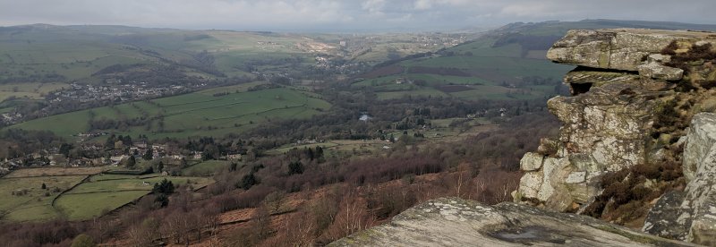
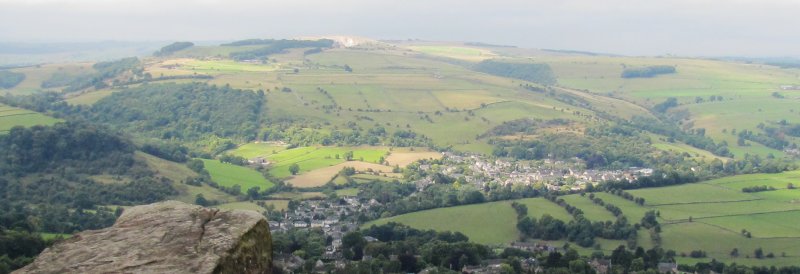
This is a fantastic moderate walk offering some good views and interesting scenery. Care should be taken especially when descending from Curbar Edge itself.
How to get there
Take the A619 from Bakewell, heading towards Chesterfield. Upon reaching a roundabout, follow signs for Manchester and Stockport on the A623. Turn left at the mini roundabout through the village. Stay on this road until you see signs for Froggatt and Curbar. Turn right, and continue until you come to a church. Turn right onto Curbar Hill. The car park is on the left when you get out of the village.
Walk
1 From the car park, go up the wooden steps and follow the footpath next to the stone wall. Keep following the path, past a picnic area and through the kissing gate. The path is wide and well-made through all this section, ascending slightly to reach the ridge top.
2 The path descends, away from the ridge edge towards the right before immediately curving back to the left. Keep following the main path. Keep an eye out for a path to your left, just after the first clump of trees. Take this path which turns left just before reaching a rock face.
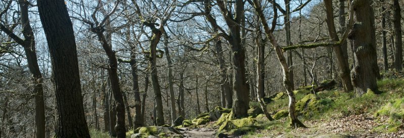
3 The path immediately descends before reaching a steep-sided wooded slope. Pass by large rock boulders into the woodland. The path levels off, keep following this path as it cuts across the hillside towards the road. When you pass a house on your right, the path descends to a gate.
4 Pass through turning left onto the road which meanders back up towards the car park.
Grid Reference: SK 262747
Safety Disclaimer
Outdoor activities always involve an element of risk. Routes, terrain, surfaces, weather, access, livestock presence, water levels, and parking arrangements can change at any time, and path conditions may deteriorate without notice.
You are responsible for your own safety and for the safety, supervision, and wellbeing of your dogs, children, and anyone else with you. Please assess conditions for yourself before setting out and decide whether the walk is suitable for your group.
Dress appropriately for the conditions and bring suitable equipment, food, water, leads, navigation tools, and anything else needed for a safe outing. Trail Tails Ltd is not responsible for loss, damage, injury, incident, or any consequences arising from use of this information.
Help Keep This Walk Accurate
If anything has changed or looks incorrect, please send us an edit or update suggestion.
Suggest an Edit or UpdateMap
Share this walk:
Other Walks Nearby
More walks nearby
Create a free account to keep exploring nearby walks and build a shortlist.
Create Free Account
Comments & Reviews (0)
Get More From This Walk!
Create a free account to save this walk, rate it, and share your experience.
Be the first to comment on this walk!