logo logo logo logo
  • England
    • North West
    • North East
    • Yorkshire
    • West Midlands
    • East Midlands
    • East of England
    • South West
    • South East
    • Greater London
  • Scotland
    • Highlands
    • Lowlands
    • Cairngorms
  • Wales
    • North Wales
    • South Wales
    • Snowdonia
    • Anglesey
  • National Parks
    • Lake District
    • Peak District
    • South Downs
    • Snowdonia
    • Cairngorms
  • Dogs Welcome
  • Conwy Mountain

    Conwy, Snowdonia National Park


Conwy Mountain

Circular walk

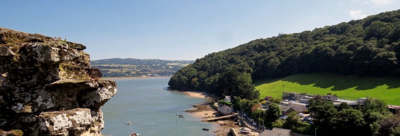
A walk which contains both coastal and mountain views, with a gentle climb to the highest point. Here, you will have views over to Conwy Castle. Downloadable map available here.

Enjoy the walk? Consider supporting the site.

Useful Information

How to get there: Follow the Sychnant Pass road from Conwy. After you pass on your left, a road leading to a car park, not long after you will find some a reasonable sized lay-by, where you can park, on the right hand side of the road.

Grid Reference: SH 749 770
Nearest Postcode: LL32 8BJ
Parking: Multi-vehicle lay-by by the side of the road.

Distance

2.4 miles

Difficulty

Moderate

Time

1hr 15min

Advertisement

The Walk

A walk with views of Conwy Castle.

Map with thanks to Ordnance Survey.

Walk

1 From the car park, face away from the road and take the path to the left. The path will level out and you will find a stone wall to your right. Ignore a path to the left before reaching a marker.

2 Follow the route marker toward Llwybr Cyhoeddus taking the footpath to the right. Pass through a metal gate and go on straight ahead, cutting through the middle of the hillside. Upon reaching another path, cross over this and head straight on following the North Wales Path. You will find that the path widens out, offering some coastal views. When you reach another path, turn right. When you reach a fork in the path, take the left path. Ignore a path to the left, then another to the right.

3 When you reach another fork in the path, take the path to the right. After this, ignore paths to the right, and continue on the path you are on, with it beginning to descend in a short while.

4 Once the path levels out, turn back on yourself and progress to the path which is ahead of you on the left. You will be heading back in the direction you came from, but on a lower path instead. Continue on the grassy path, then take a path on the left which descends toward a stone wall. Turn right once you reach the track. Remain with the stone wall on your left for a while, then keep to the track where the wall reaches a corner. You will join up with the begininning section of this route, with a path on your left. This will incline slightly, before descending again through the middle of the hillside and back through the gate. When you reach the track, turn left to continue back to the lay-by where you parked.

Similar Walks

Two further walks to consider in Snowdonia National Park.

Aber Falls Aber Falls, Snowdonia National Park - Dog Walks Near Me

1hrs 15min

Time

2.5 miles

Distance

Easy

Difficulty

Aber Falls

Linear Walk

Snowdonia National Park

Devil's Kitchen Devil's Kitchen, Snowdonia National Park - Dog Walks Near Me

1hrs 15min

Time

2.7 miles

Distance

Easy

Difficulty

Devil's Kitchen

Circular Walk

Snowdonia National Park

Enjoy this walk?

Say thanks with a coffee.

Our Affiliate Partners

North Face
client logo
Berghaus
Ordnance Survey
Jack Wolfskin UK
AATU
Dog Walks Near Me
  • Find dog walks across the UK
  • About Us
  • Sticker Competition
    (win £50)
Top Walk Areas
  • Peak District National Park
  • Lake District National Park
  • Cornwall Region
  • South East Region
Dogs Welcome
  • Find dog friendly businesses
    across the UK

  • Own a dog friendly business?
    Advertise with us (free listings
    are available)
Home & Garden
  • A blog where we share additional content related to the wider-world

Contact Us
  • Email
© Dog Walks Near Me | Cookie & Privacy Policy