-
Swallow Falls
Snowdonia National Park
Swallow Falls
Circular walk
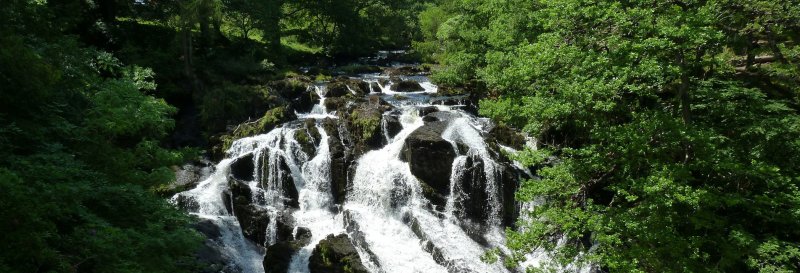
A circular walk at Swallow Falls. Swallow Falls is the highest continous waterfall in Wales. Downloadable map available here.
Useful Information
How to get there: Take the A5 out of Betws-y-Coed towards Capel Curig. Once you pass by the Swallow Falls Hotel on your left, remain on the A5 a little further, then take the minor road immediately before Ty Hyll tea room. Follow on this road until you reach the car park.
Grid Reference: SH 765 583
Nearest Postcode: LL24 0DH
Parking: Ty'n Llwyn Forestry Commission car park.
2 miles
Moderate
1hr
The Walk
A circular walk taking in a waterfall, woodlands and forest.
Map with thanks to Ordnance Survey.
Walk
1 From the car park, facing the road, turn left and go through a gap in the stone wall. Cross through the picnice area, then follow the yellow way markers along a path, then pass through a gap in the fence. You will then pass through an open wooded area, followed by another gap in the fence. You will then descend whilst on the path, and you will pass on by a path on the left.
2 The path will take a left bend, before bending sharply to the right and then a bit further on will bend again to the left, when it ascends again. You will bend again on the path to the right, before reaching a set of stone steps before you head down the hill. The path will narrow before you meet another, wider, track. Cross this path then continue to descend. Pass through a gap in the wall, remaining on the path. When you reach the fork in the track at the bottom of the steps, take the right track and remain on this path for a while. You will see the river, Afon Llugwy, on your right. Don't take the path on your right, then a bit further on ignore the path on the left. Just after this, there will be a narrow path to your right. If you take this path, you will reach a close up view of the waterfall.
3 Back on the path, turn right to continue until you reach a set of steps to your right. These lead to a bench and viewing area to take in the waterfall. When back on the path, turn right before you reach a fork in the path. Take the left path to climb back up. Turn left when you reach the next path, then turn right upon reaching another path. When the path descends further, take the steps on the left.
4 Follow the yellow way markers for a while. There is a viewpoint just off the path here. When you return to the path turn left. Pass through a gap in the wall, then follow the grassy path. When you reach another path, turn right to head back to the car park.
Enjoy this walk?
Say thanks with a coffee.
Our Affiliate Partners