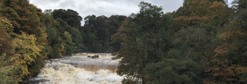
Aysgarth Falls

Published on | Category: Yorkshire | Location: Yorkshire Dales National Park
Featured image for Aysgarth Falls

Walk Highlights

Location:
Yorkshire Dales National Park
Postcode:
DL8 3TH
Parking:
Aysgarth Falls National Park Centre.
Distance:
2.00 miles
Time:
1.00 hours
Difficulty:
Easy
OS Map Route:
View Route on OS Maps

Aysgarth Falls include a number of small waterfalls which create beautiful dramatic scenery and are part of the River Ure. The walk begins by walking through woodland and across pasture fields, before turning back to arrive at the three waterfalls - Lower Force, Middle Force, and High Force.


How to get there

The walk starts and finishes from the Aysgarth Falls National Park Centre, which has a pay-and-display car park, toilets and cafe. It is marked with brown tourism signs from the A684 in Aysgarth village.


Walk

1 Leave the car park and then head through Freeholders' Wood.

2 Pass through St Joseph's Wood and out of the woodlands, then reach the highest point on the walk in the fields leading to Hollins House.

3 Once you have reached the farmyard at Hollins House, follow south west through the fields to return to St Joseph's Wood.

4 You will head toward and reach the water here, passing Aysgarth Lower Force, Middle Force, and finally High Force. Follow on back toward the road and car park.


Grid Reference: SE 011 887

Information Accuracy

While we strive to ensure all walk details are accurate and up-to-date, conditions can change. Please verify critical information locally where possible. Dog Walks Near Me cannot be held accountable for errors or omissions in the provided walk information. Your safety is your own responsibility.

Report an Issue with this Walk

Map

View full route on OS Maps

Share this walk:

Comments & Reviews (0)

Log in or register to leave a comment.

Be the first to comment on this walk!