logo logo logo logo
  • England
    • North West
    • North East
    • Yorkshire
    • West Midlands
    • East Midlands
    • East of England
    • South West
    • South East
    • Greater London
    • Lake District
    • Peak District
    • South Downs
  • Scotland
    • Highlands
    • Lowlands
    • Cairngorms
  • Wales
    • North Wales
    • South Wales
    • Anglesey
    • Snowdonia
  • Holiday Cottages
  • Store
  • Blog
  • Staithes & Port Mulgrave

    North Yorkshire

Staithes & Port Mulgrave

Circular walk

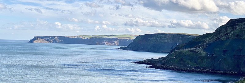
A walk through fields, lanes and along the cliffs. Starting at the old fishing village of Staithes, you will follow the Cleveland Way National Trail for part of the walk, along to Port Mulgrave and the coastal views this brings.

Useful Information

How to get there: Staithes is located off the A174 main road, between Whitby and Loftus.

Grid Reference: NZ 781185
Nearest Postcode: TS13 5AD
Parking: Staithes car park.
Facilities: Toilets.

Distance

4 miles

Difficulty

Moderate

Time

2 hrs

The Walk

A walk through fields, lanes and along the cliffs.

Map with thanks to Ordnance Survey.

Walk

1 From the car park, turn right to head down the hill. You will pass by a pub (Cod & Lobster) where you should take a right turn to head up the road.

2 At the top of the road, continue ahead (signposted to Cleveland Way, Port Mulgrave) and through the alley. Take a left at the next signpost for Cleveland Way. Follow this cliff-top path.

3 You will reach a gate which you should progress through, and continue on into the village and head along the road.

4 Take a right to head along a stone track when you reach the post box. Take a left after the final building to cross the fields. The path will then head downhill to the A174 road.

5 Carefully cross over the main road and into the lay-by, heading right into it, and then left at the public footpath sign, heading into the woods. The path continues downhill, where you will cross over a bridge and then head left following the path up the hill.

6 You will find the path taking a sharp right turn to leave the wooded area. Continue on the path, taking a right over the bridge and head toward Dalehouse (signposted).

7 Once you reach the road, turn right to head uphill (named Dalehouse Bank), meeting the A174 again. Take a right here, then a left onto Staithes Lane, returning to the car park.

Similar Walks

Two further walks to consider in Yorkshire.

Runswick Bay Runswick Bay, North York Moors National Park - Dog Walks Near Me

45mins

Time

2 miles

Distance

Easy

Difficulty

Runswick Bay

Linear Walk

North York Moors National Park

Robin Hood's Bay Robin Hood's Bay, North Yorkshire - Dog Walks Near Me

1hr 20min

Time

2.9 miles

Distance

Moderate

Difficulty

Robin Hood's Bay

Circular Walk

North Yorkshire

Enjoy this walk?

Say thanks with a coffee.

Our Affiliate Partners

North Face
client logo
Berghaus
Ordnance Survey
Jack Wolfskin UK
AATU
Dog Walks Near Me
  • Find dog walks across the UK
  • About Us
  • Support Dog Walks Near Me
Top Walk Areas
  • Peak District National Park
  • Lake District National Park
  • Cornwall Region
  • South East Region
Own A Dog Friendly Business?
  • Advertise with us. This is ideal if your business is a dog friendly place to visit such as gardens, secure dog fields, museums, zoos, etc.
Mahlow the Greyhound
  • A blog where we share additional content related to the wider-world

Contact Us
  • Email
© Dog Walks Near Me | Cookie & Privacy Policy