
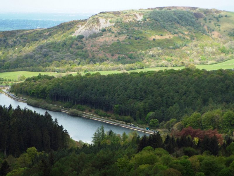
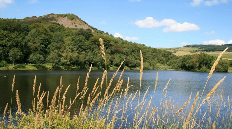
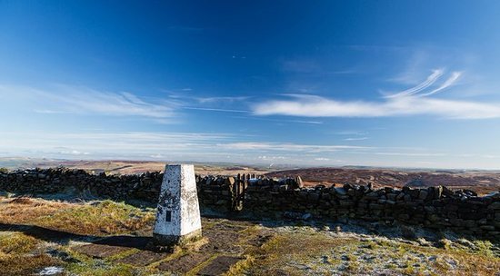
Macclesfield Forest
Walk Highlights
- Nearest Town:
- Macclesfield
- Postcode:
- Unlock Postcode
- Parking:
- Unlock Parking Info
- Distance:
- 4.50 miles
- Time:
- 2.50 hours
- Difficulty:
- Moderate
- Terrain:
Terrain: Predominantly coniferous forest with some mixed woodland. Main forest roads are wide, well-surfaced (compacted stone/gravel), and can be steep in places but offer good footing. Smaller footpaths are earthier, often very uneven, rooty, rocky, and can be extremely muddy and boggy, especially after rain or on higher routes. The forest covers hilly terrain with significant ascents and descents. Some paths include stone pitching or steps.
- Facilities:
- Toilets, Cafe
- Get Directions:
- Unlock Driving Directions
Create a free account to make this useful beyond one walk
Save walks, build a shortlist, report current conditions, and join the local dog-walking community.
3-Day Dog Walking Forecast
Ground Conditions
No reports yet. Walked this recently?
Dog-Centric Details
- Stile-Free Walk:
- ••••••••••••••••••••••••Unlock
- Poo Bins Available:
- ••••••••••••••••••••••••Unlock
- Secure/Fenced Area:
- ••••••••••••••••••••••••Unlock
- Dog Water Source:
- ••••••••••••••••••••••••Unlock
- Dog Notes:
- ••••••••••••••••••••••••Unlock
- EV Charger Nearby:
- ••••••••••••••••••••••••Unlock
- Fuel Station Nearby:
- ••••••••••••••••••••••••Unlock
- Livestock Information:
- ••••••••••••••••••••••••Unlock
- Off-Leash Policy:
- ••••••••••••••••••••••••Unlock
- Dog Traffic:
- ••••••••••••••••••••••••Unlock
- Seasonal Advice:
- ••••••••••••••••••••••••Unlock
- Height Restriction:
- ••••••••••••••••••••••••Unlock
- Printable Version:
- Upgrade to Plus to Print
About this Walk
Know Whether This Walk Suits Your Dog
Unlock the practical details that reduce uncertainty before you leave home: parking, route guidance, dog-specific advice, and the map tools for repeat use.
Essentials
Useful for planning this walk
*Billed £14.99 yearly
- Unlock parking and postcode details
- Get driving directions to the start point
- Read the full walk guide instead of the teaser
Plus
Best for confident repeat discovery
*Billed £29.99 yearly
- Everything in Essentials
- Dog-specific details like off-lead policy, livestock, dog traffic, and seasonal advice
- Interactive OS Maps, GPS tracking, and printable routes
- Offline access for planning walks again and again
Already a member? Log In
Safety Disclaimer
Outdoor activities always involve an element of risk. Routes, terrain, surfaces, weather, access, livestock presence, water levels, and parking arrangements can change at any time, and path conditions may deteriorate without notice.
You are responsible for your own safety and for the safety, supervision, and wellbeing of your dogs, children, and anyone else with you. Please assess conditions for yourself before setting out and decide whether the walk is suitable for your group.
Dress appropriately for the conditions and bring suitable equipment, food, water, leads, navigation tools, and anything else needed for a safe outing. Trail Tails Ltd is not responsible for loss, damage, injury, incident, or any consequences arising from use of this information.
Help Keep This Walk Accurate
If anything has changed or looks incorrect, please send us an edit or update suggestion.
Suggest an Edit or UpdateOther Walks Nearby
If this one is not quite right, here are more local options to compare.
More walks nearby
Create a free account to keep exploring nearby walks and build a shortlist.
Create Free Account
Comments & Reviews (0)
Join Free to Save and Discuss Walks
Create a free account to save this walk, rate it, report conditions, and share your experience with other dog owners.
Be the first to comment on this walk!